Climate and Disaster Risk Reduction Ecosystem Map
The Uganda Climate and Disaster Risk Reduction (DRR) ecosystem map is one of the resourceful tools developed by Uganda Response Innovation Lab (U-RIL) with support from Save the Children. The map was developed as a key output of the Climate Adaptive Programming and Disaster Risk Reduction Stakeholder Mapping project in Uganda with an overall objective to build knowledge, capacity, and understanding of the Ugandan Climate Change Action context and Climate Adaptive programming options through stakeholder mapping, child and youth consultations, staff learning, and evidence/impact documentation.
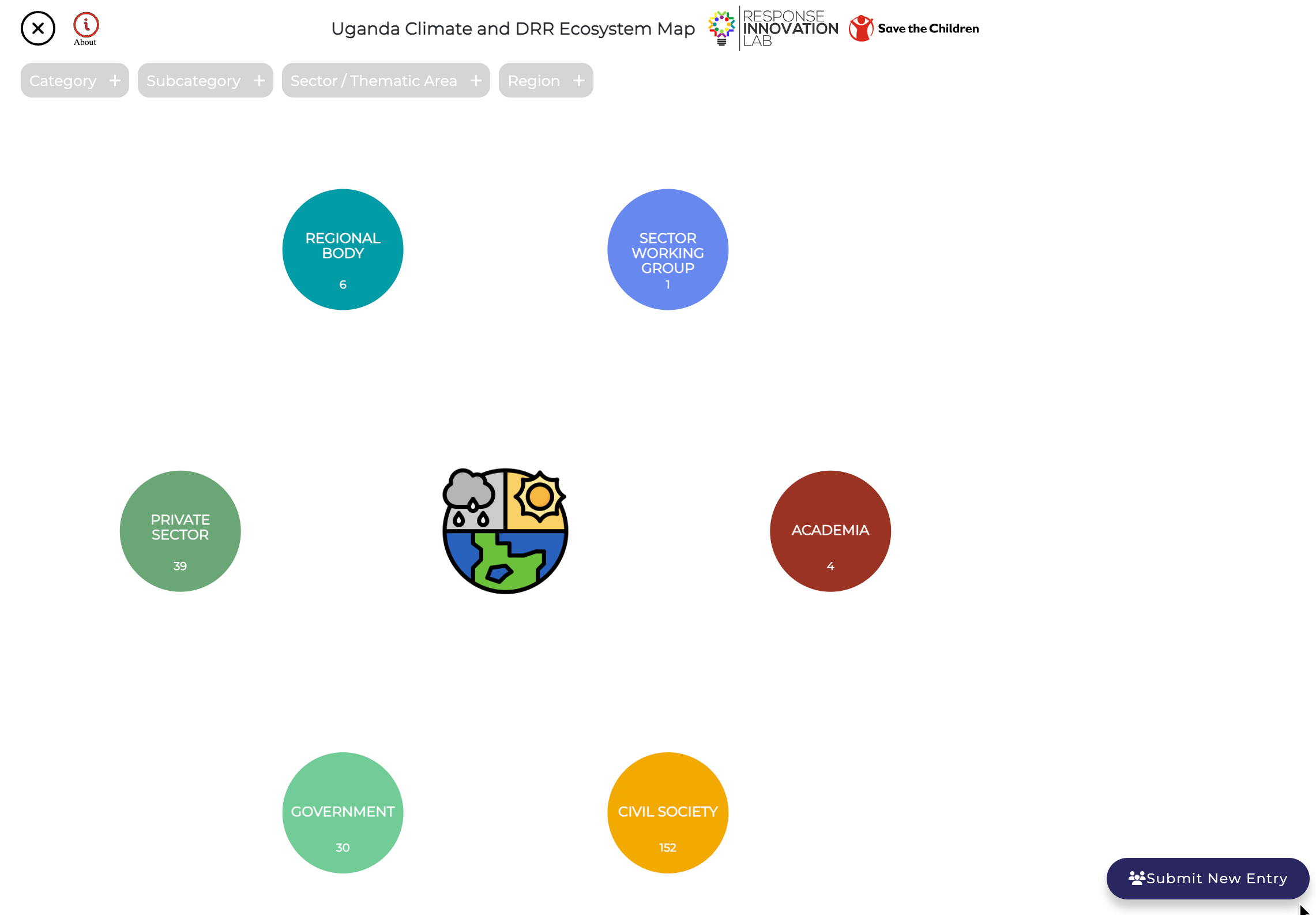
The interactive ecosystem map showcases community, national and international stakeholders stakeholders such as Academia, Government, Civil Society Organizations (CSOs), Private Sector, Regional bodies and Sector Working groups engaged in Climate Adaptive Programming and Disaster Risk Reduction (CAP and DRR) work across 6 regions in Uganda. With the filter feature embedded, the map has 4 filter tabs (category, subcategory, sector/thematic area and region) that enable one to search for actors according to stakeholder category and subcategory, thematic area and region of operation. While most stakeholders mapped have a physical presence in Uganda, some are based externally with CAP and DRR work implemented in Uganda.
This map is a live tool that is regularly updated, if your organization is not yet represented or you wish to request a change/update to the information about your organization, please fill a request through the form link attached to the map. Click on this link to access the map.